You are using an out of date browser. It may not display this or other websites correctly.
You should upgrade or use an alternative browser.
You should upgrade or use an alternative browser.
Aerial photographs
- Thread starter RBailey
- Start date
Feltwell
Member
- Messages
- 6,379
- Location
- Shropshire, England
I took a look at this yesterday. For here, it seems the historical images are the same as the ones on "Britain from Above", but they've added modern images. Interesting to see them (almost) side by side - you can open each image in a separate tab. I was looking at Ironbridge yesterday, which is just down the road from me, comparing 1934 to now.
CliffordPope
Member
- Messages
- 1,023
I'm sure I'm being very thick, but how does this work? I can see a pale green outline of the bit I want to look at, but I can't make any of the buttons produce any pictures.
The "How to" button gives a list of things I could do, but doesn't explain how to activate them. What am I missing?
The "How to" button gives a list of things I could do, but doesn't explain how to activate them. What am I missing?
Feltwell
Member
- Messages
- 6,379
- Location
- Shropshire, England
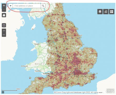
Start off by entering a postcode or place name in the box at the top

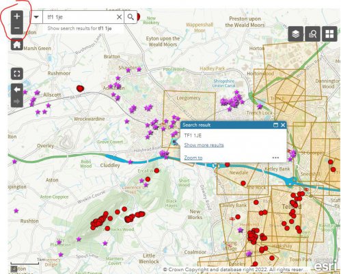
That takes you to a local view, though you'll probably have to use the plus button and drag the map around to see enough detail

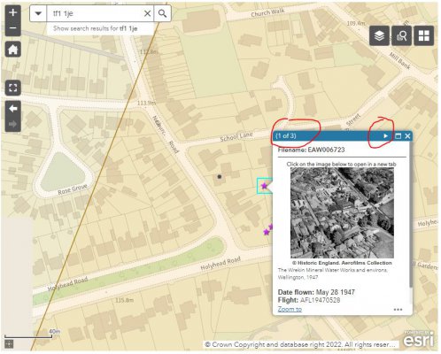
Then click on the little purple stars or red dots to see images, if there's nothing highlighted there are no images for that area. One to watch is that a single star can load multiple images - so below it's 1 of 3, and you need to use the little right arrow to see the others - easy to miss.

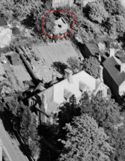
Here's Feltwell Towers in 1947, to me it shows a mysterious small ruined building at the end of the garden - I've found the floor slab for this, no idea what it was for. It also showed me that previous occupants here were rather cheeky, when the brewery behind was knocked down they nicked a strip of land across the end of the garden! :lol: It's mine with the Land Registry now so I'm not fussed.....

That takes you to a local view, though you'll probably have to use the plus button and drag the map around to see enough detail

Then click on the little purple stars or red dots to see images, if there's nothing highlighted there are no images for that area. One to watch is that a single star can load multiple images - so below it's 1 of 3, and you need to use the little right arrow to see the others - easy to miss.

Here's Feltwell Towers in 1947, to me it shows a mysterious small ruined building at the end of the garden - I've found the floor slab for this, no idea what it was for. It also showed me that previous occupants here were rather cheeky, when the brewery behind was knocked down they nicked a strip of land across the end of the garden! :lol: It's mine with the Land Registry now so I'm not fussed.....
Feltwell
Member
- Messages
- 6,379
- Location
- Shropshire, England
CliffordPope
Member
- Messages
- 1,023
Many thanks indeed for that guide. I think my problem was simply that there are very few aerial images of anywhere I've wanted to look at!
I think I was expecting the aerial photograph archives to be integrated into the Google satelite / Google Earth set-up, and it appears it isn't.
Recently I was looking at a particular section of the River Cam in Cambridge where we used to keep a boat in a boathouse in a dock. The outlines of the network of channels, slipways etc at the old boatyard are now abandoned and have gone back to nature, but clicking on Google historical view there is an aerial photograph dated from 1945 which has been perfectly re-scaled so that it aligns perfectly with the satelite images of later years. So I can see the docks, the old boathouses, boats moored, etc, in relation to the features still existing.
Yet on the example site there are no images shown at all, hence my difficulty finding any. I thought I'd give the new site a try at a place where I knew an old image existed.
It seems a pity that there therefore seem to be several databases to view historical images, with no coordination between them.

